


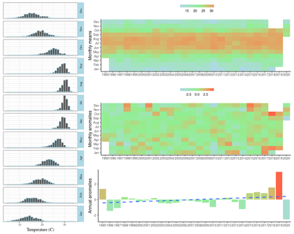
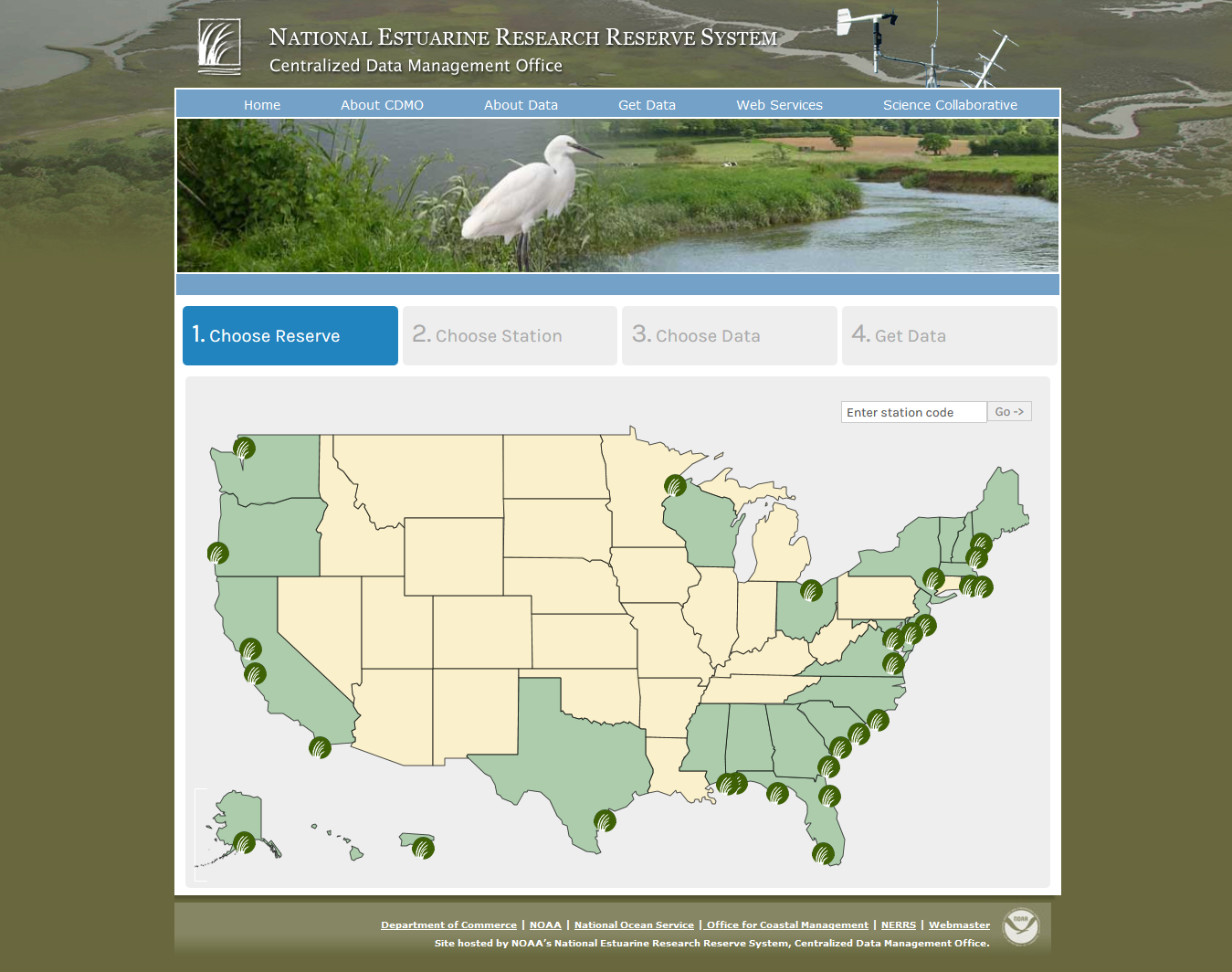
Data Graphing and Export System
The DGES was developed to provide the majority of users with quick and easy access to SWMP data. The DGES utilizes an intuitive map-based interface and offers single station exports, yearly authenticated file downloads (these may include non-standard nutrient parameters), charting, and a current conditions display for real-time stations. A quick start tutorial is also available here .

Advanced Query System
The AQS was developed to specifically address the data delivery needs of those end-users looking for large amounts of data exported in a format that can be easily imported and manipulated for data analysis. The AQS offers three different query options allowing for mass downloads of annual files, customized queries for specific parameters and multiple stations in the same file, and an option to merge water quality, meteorological and nutrient datasets.

Real Time Data Application
The Real Time Application allows users to view near real time SWMP data from any browser or mobile device. Current conditions and 48 hour graphs are available in either metric or English units. Explore and select available stations, add favorite stations, or use a bookmarked link to access your station directly.


Vegetation Monitoring Application
The Vegetation Monitoring Application delivers submerged aquatic vegetation (such as eelgrass and algae) and emergent vegetation (such as salt marshes and mangroves) monitoring data for participating Reserves. Parameters monitored include percent cover of all plant species, as well as stem density and canopy height of the common species.